Caminos del Agua: "Cerro de los Viejos" Archaeological Landscape

Inauguration of the walking trail with the general public and working groups. December 2019. Photo: Rodrigo Pérez. Secretaría de Cultura de La Pampa.
This site registers a continuous use of the landscape by indigenous populations for at least 6000 years and until the end of the 19th century, when the so-called “Conquista del Desierto” (Conquest of the Desert) in 1878 led to the diaspora of indigenous groups. The Conquista del Desierto was a political, economic and military project of the Argentinian State aimed at undermining the autonomy of the region’s indigenous towns.

Lonkos Ranquel, Ana Domínguez and Inés Canhue in the inauguration of the walking trail. December 2019. Photo: Rodrigo Pérez. Secretaría de Cultura de La Pampa.
The Caminos del Agua project, promoted by the Secretariat for Culture of La Pampa, includes a coordinated management plan with other provincial areas and institutions such as the Provincial Council of Aboriginal People (Consejo Provincial del Aborigen), Tourism, Highways, the Public Library of Cuchillo Co, as well as the municipality of La Adela. Cuchillo Co and La Adela are located near the site. The Association of Friends of the Ethnographic Museum Juan B. Ambrosetti from the University of Buenos Aires, and the archaeology team of the western pampa, coordinated by the Museum’s director, Dr. Mónica Berón, carry out scientific research on the site.
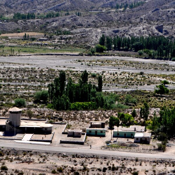
Cerro de los Viejos is an open-air archaeological trail that offers interactive spaces with technological applications aimed at the dissemination of site research and the transfer of scientific knowledge to the general public. The project covers the design of a 2500-meter-long interpretation path developed by Argentine agency Tamandúa Estudio.
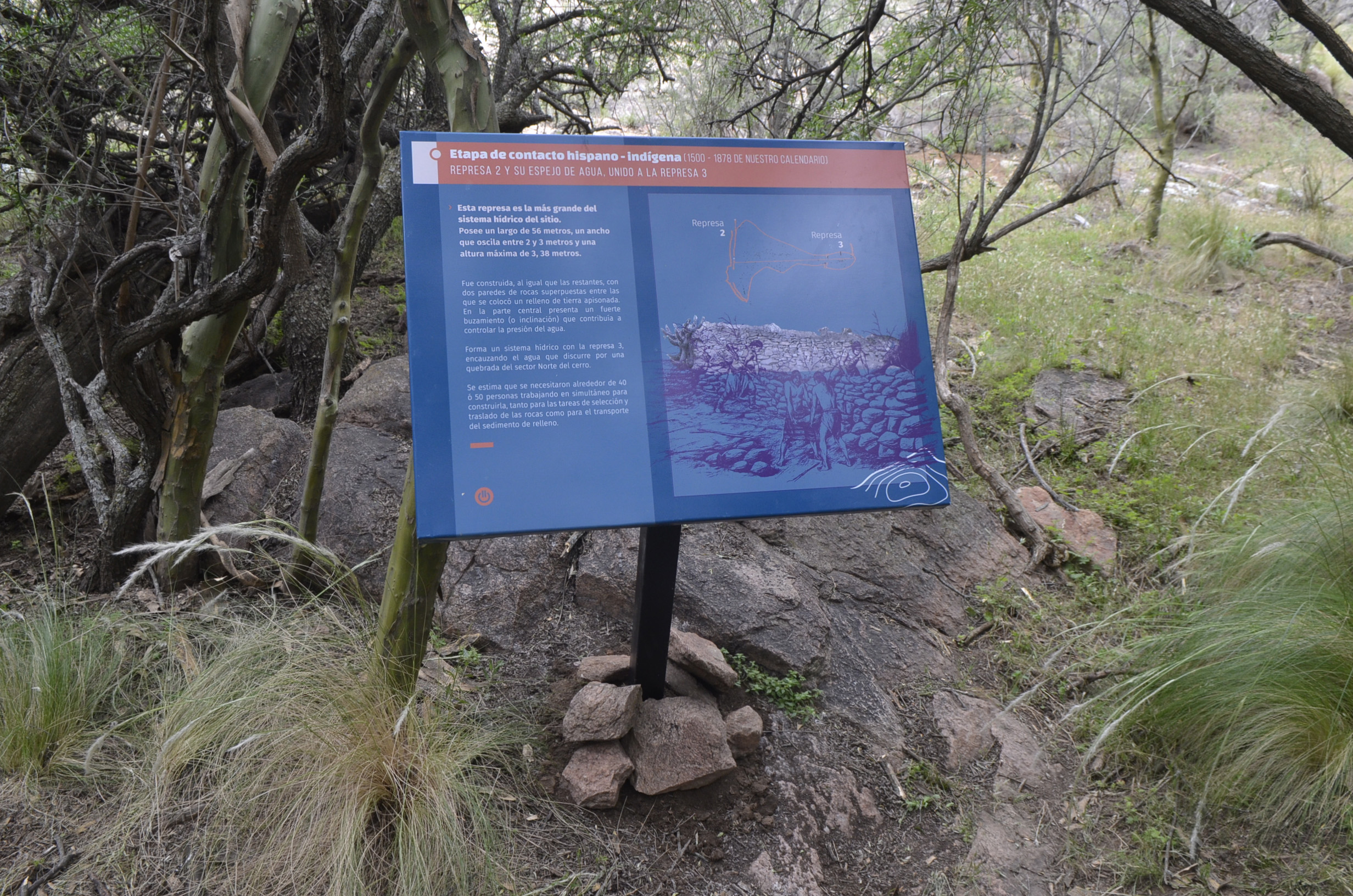
Photo: Sign with Augmented Reality technology in ‘Cerro de los Viejos’. By Rodrigo Pérez, Secretaría de Cultura de La Pampa.

Flyer with Augmented Reality technology for the project dissemination. Photo: Secretaría de Cultura de La Pampa.
One particular feature of the trail is that three out of nine signs are designed to activate augmented reality experiences, through a free downloadable application for mobile devices called CamOnApp. This app was developed by entrepreneurs from the pampas.
When scanned on the mobile devices, these signs activate videos, animations, audio and images that interact with the surroundings, creating a unique experience for visitors to the site.
Thanks to a contribution from SDCELAR, it was possible to adapt the application to work without an internet connection, using previously installed data packages. This is useful given the lack of internet and mobile signal in the area.
Another important aspect of the project is the participation of indigenous groups and local residents.
Although Cerro de los Viejos is public heritage of the Pampas, the site is located on private property, which is used for cattle rearing.
The owners of this land, the Iturrioz family, are a third generation of criollo inhabitants in the region. They participate actively and sensibly towards the enhancement of this heritage site and are happy for it to be open to the public.
Photo: Lonko ranquel Ana María Domínguez in ‘Cerro de los Viejos’. December de 2019. By Rodrigo Pérez, Secretaría de Cultura de La Pampa.

Ranquel, Argentina and wiphala flags. Photo: Rodrigo Pérez, Secretaría de Cultura de La Pampa.
This site constitutes a representative identity landmark for neighbouring local areas. The project places special emphasis on collaborative work with indigenous communities from the region. The goal of the project is to promote the participation of people from the towns of Ranquel and Mapuche as guides and hosts at the site. The project recognises indigenous rights to manage their heritage in the Pampa region.